Unit 2 - United States in Spatial Terms
If absent, please go through this page to see what you need to do. You may need to find different handouts or page pieces in the extra copies tray of Ms. Smith's Room to complete your work.
Click "download file" below if you need an extra copy of the study guide. Use your social studies notebook to help you prepare. If you are missing any of the information, please scroll down and find it on this page.
| Unit 2 Study Guide |
Day 1
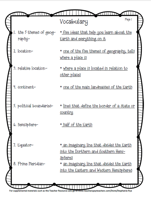
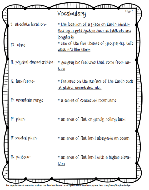
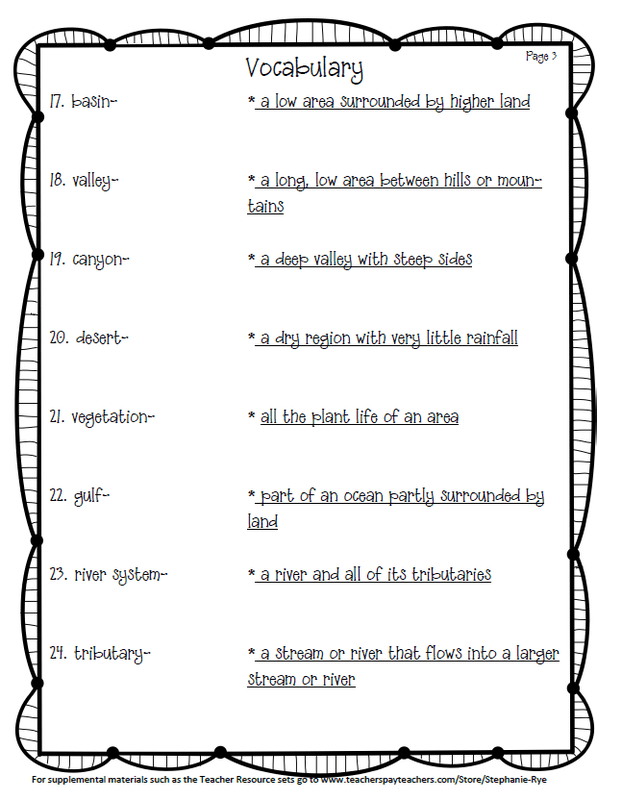
Add the 24 new vocab words to the WWK section of your notebook. Click on each image to enlarge.
|
|
|
Day 2
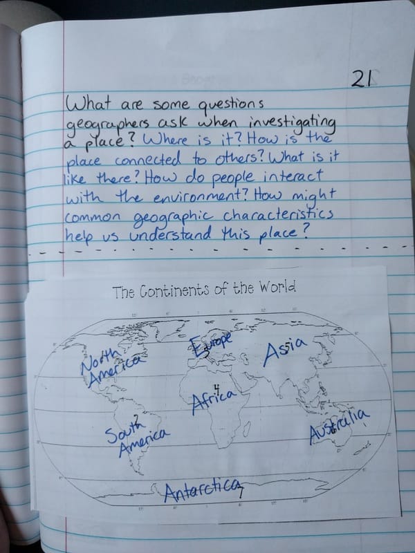
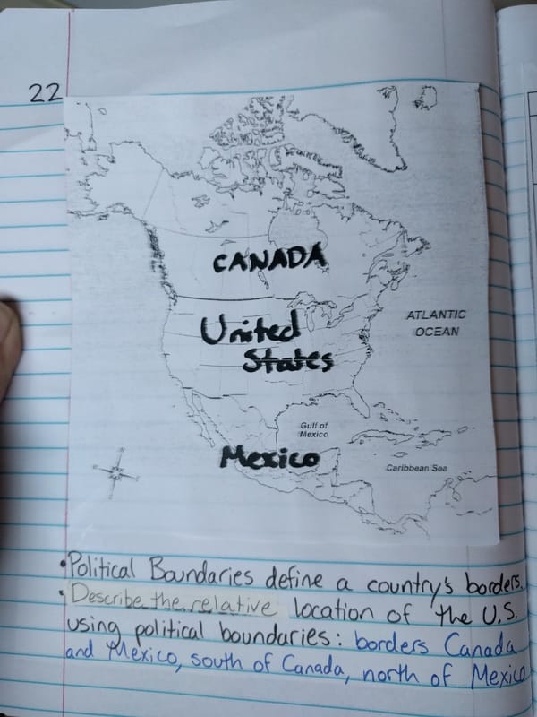
Complete notebook pages 21 and 22 as shown below. Click on each image to enlarge.
|
|
Day 3
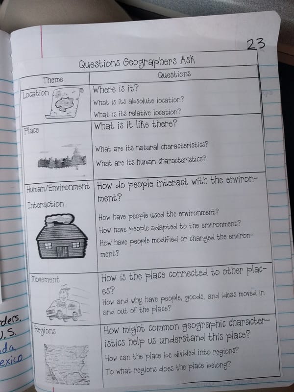
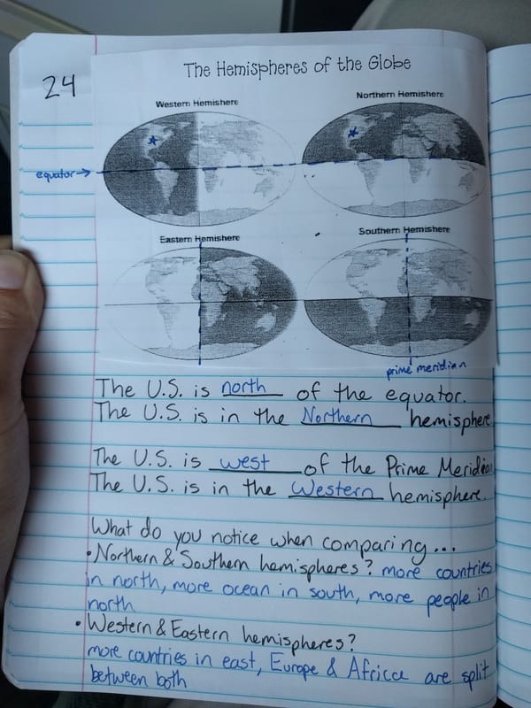
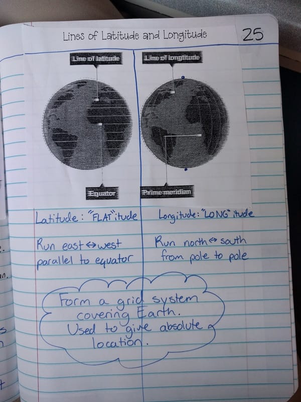
Complete notebook pages 23, 24, and 25 as shown below. Click on each image to enlarge.
|
|
|
Day 4
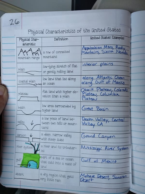
Complete page 26 of your notebook as shown below. Click on the image to enlarge.
Day 5
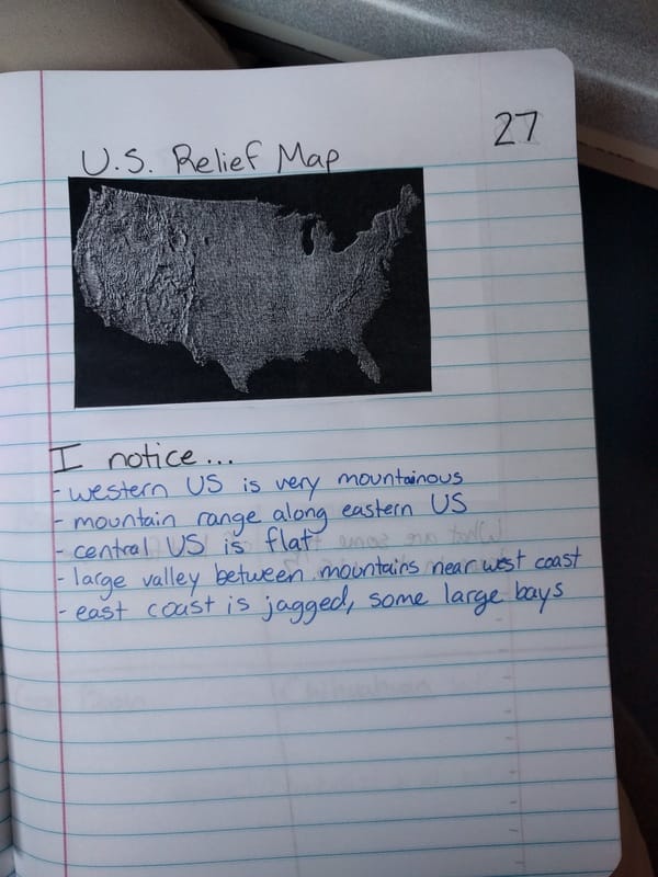
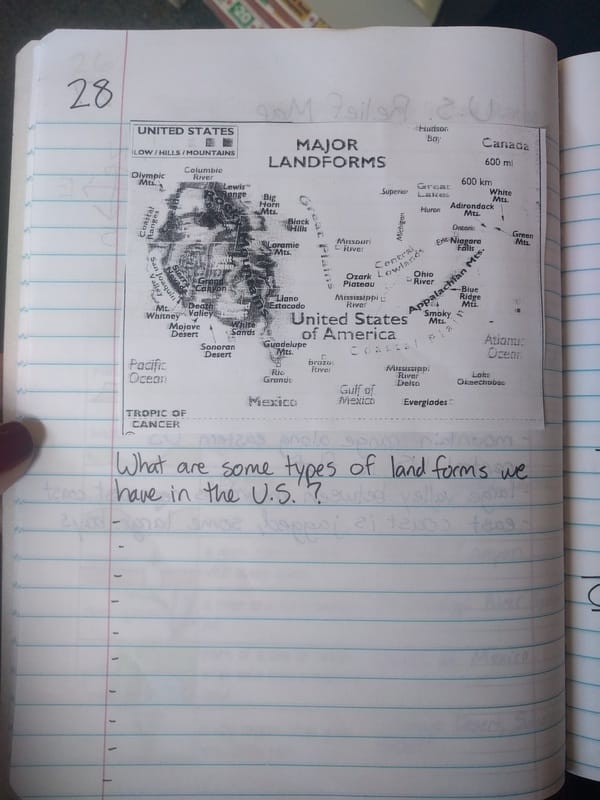
Complete pages 27 and 28 of your notebook as shown below. Click on each image to enlarge.
|
|
Day 6
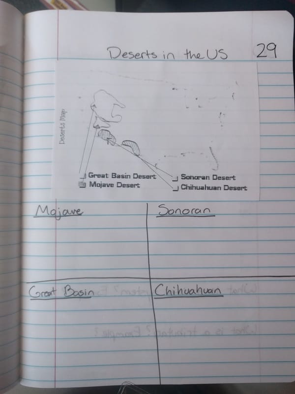
Complete page 29 of your notebook as shown below. Read the deserts article and write down facts about each desert in the boxes on page 29.
Day 7
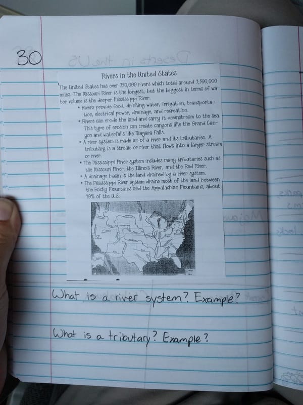
- Create page 29 of your notebook as shown below (click image to enlarge). Read the information in the Rivers passage and answer the questions on the bottom of the page.
- Click here to watch "Geographical Features: Bodies of Water" on Discovery Education (14 minutes).
- On page 30, write down a list of interesting facts from the video that you didn't know before.
Day 8
- Review vocabulary words (Vocab Swat game in class)
- Go on goformative.com, click dashboard or login, login with google
- Click your class name
- Open and take the Unit 2 Part 1 Vocab Quiz
Day 9
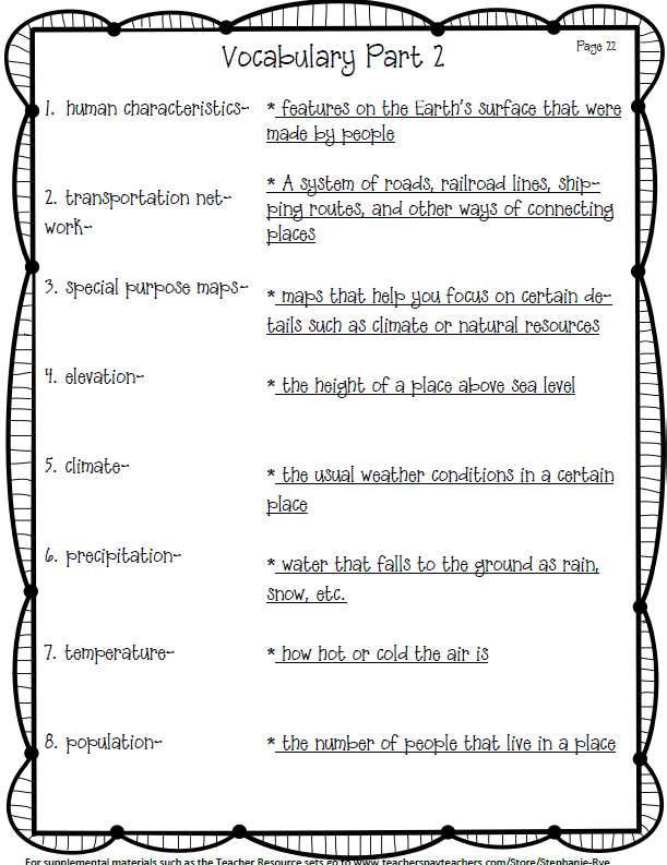
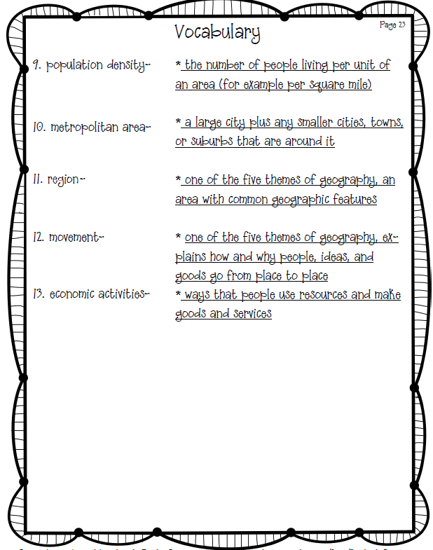
- Add the 13 new Unit 2 Part 2 Vocab Words (2 images below) to your WWK section of your notebook. Click images to enlarge.
|
|
Day 10
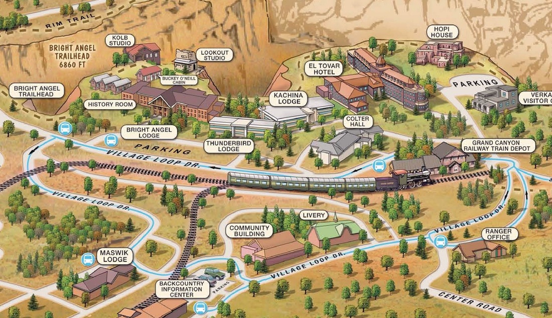
- Look at the Grand Canyon south rim map (below). Click it to make it full size.
- On page 31 of your notebook, use the top half of the page to list any inferences you can make from the map. Use the bottom half of the page to list any human characteristics you see on the map.
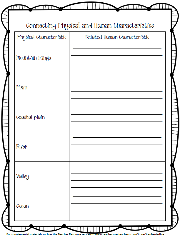
- Glue "Connecting..." (found below) to page 32. Click it to view full-size. List some human characteristics that are often built near each of the physical characteristics in the chart. For example, "Mountain Range" would have the related human characteristics of "mine, ski resort, tunnel" because these things are often built in/on/near mountains.
|
|
Day 11 and 12
- Go to classroom.google.com
- Login
- Go to the City Search assignment
- Read the instructions and complete page 33 and 34 in your notebook by answering the questions.
Day 13
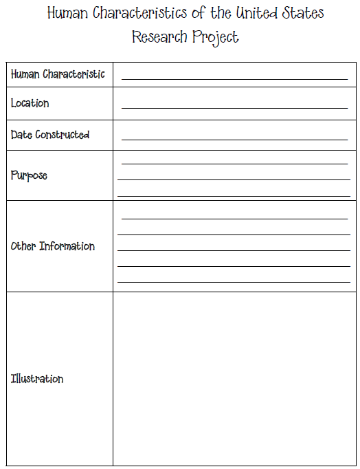
- Look at the list of important U.S. Human Characteristics (below) and choose one to research.
- On page 35 of your notebook, glue in the research chart (below) and fill it out with information you find about your chosen human characteristic.
|

|
- Page 36, title "Special Purpose Maps". Make a bulleted list of different types of special purpose maps we talked about in class, such as elevation, mean daily temperature, precipitation, climate, population density, light pollution, vegetation, any others you can think of.
Day 11
- Add to page 36 any new types of Special Purpose Map we talk about.
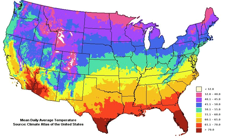
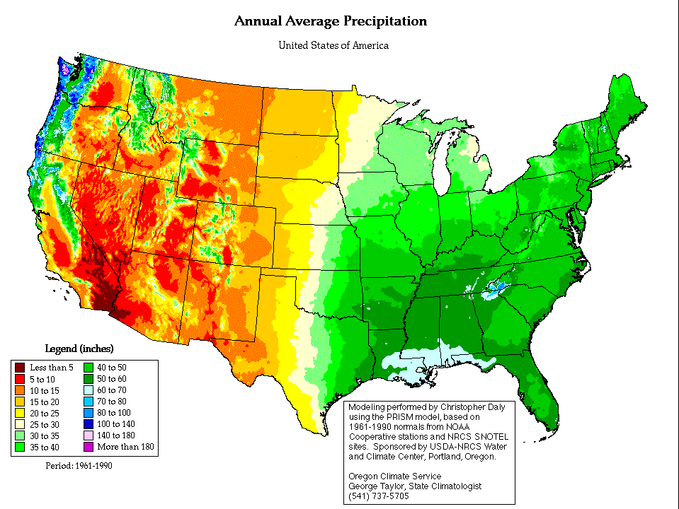
- On page 37, write "Special Purpose Maps". Choose any state. Use the temperature and precipitation maps below to tell me about the climate in that state. For example, "Michigan gets about 30-35 inches of rain each year and has an average temperature of 40 to 50 degrees." Click each map to enlarge it.
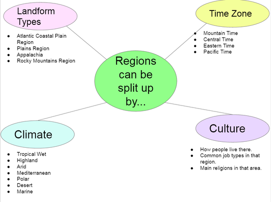
- Title page 38 "Regions". Copy the web chart below.
|
|
|
Day 12
- Complete page 39 "Describing A Region" (click below to download and print)
| Describing a Region |
- Circle your chosen region, either American West, American Northeast, American Southwest, or American Southeast.
- Go to the wikipedia page for that region.
- Fill out the chart, answering all questions about that region.
- If you have extra time, use page 39 to write a few sentences comparing your chosen region to the midwest.
Day 13
- Vocab Quiz Part 2 on goformative
Day 14
- Unit 2 Assessment on goformative
